- Home /
- About GSFS /
- Campus Map and Directions
Navigate
Campus Map and Directions
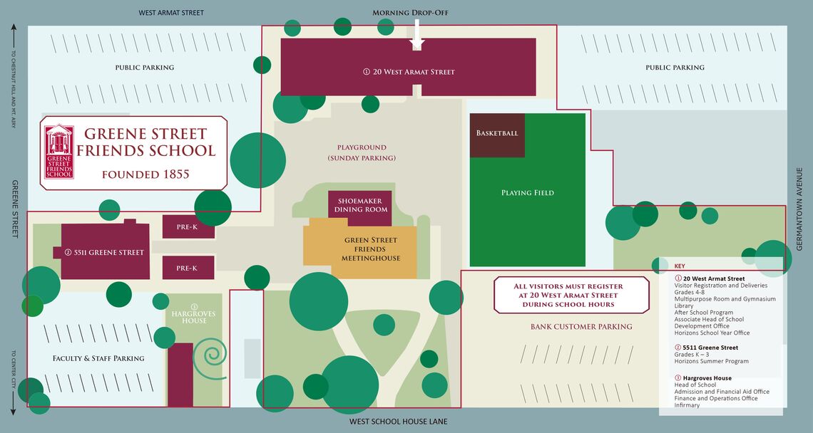
Please enter campus through the main entrance at 20 West Armat Street.
-
 Driving Directions:From 76 East or West:
Exit to Lincoln Drive, turn right at Rittenhouse exit. Follow Rittenhouse up to Wayne Avenue, turn right. Go two blocks to Armat Street, turn left. Cross Greene Street and park in the public PPA lot on the corner of Armat and Greene Street, or on the corner of Armat and Germantown Avenue. On-street, metered parking may also be available.
From Germantown Avenue (from Mt. Airy, Chestnut Hill, Erdenheim, Flourtown, Lafayette Hill, Plymouth Meeting, Norristown):
Follow Germantown Avenue South. Cross Chelten Avenue. Turn right on Armat Street, and park in the PPA lot on your left at that corner, or proceed to the next corner (Greene Street) and park in that PPA lot. On-street, metered parking may also be available.
From Lower Germantown or Nicetown (South):
Travel North on Germantown Avenue. Cross Wayne Junction. After about twelve blocks, turn left onto Armat Street, and park in the PPA lot on your left at that corner, or proceed to the next corner (Greene Street) and park in that PPA lot. On-street, metered parking may also be available.
Via SEPTA:
Greene Street Friends School is accessible by two Regional Rail trains and multiple bus routes.
Chestnut Hill East Regional Rail (Germantown Station)
Chestnut Hill West Regional Rail (Chelten Station)
Bus Route H: get off the bus at the corner of School House Lane and Greene Street.
Bus Route 23: get off the bus at the corner of Germantown Avenue and Armat Street.

